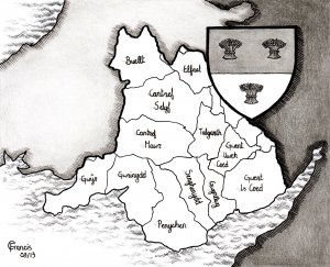
The next two illustrations are maps of Wales, the first beautifully drawn by my artist Carrie Francis.
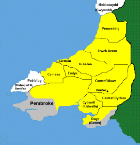
Wiiliam III de Braose extent of lands in Wales and the ancient kingdoms of Wales. I’ve written about William’s land before. King John gave him land all over the place, in England, France, Ireland and Wales. This map shows the extent of his land holding in Wales. You can read about it
here.
Long before the coming of the Normans, Wales was never a single kingdom. There were several princes at once and continual shifting of alliances and enmity. This was compounded by the Welsh custom of inheritance.
In England the rule was primogeniture: the eldest son inherited. In Wales, when a man died his estate was split between his sons, and illegitimate sons had equal rights with legitimate sons. So each kingdom became subdivided and, unless they agreed to cooperate, the sons would immediately fight to regain the whole kingdom. This made it difficult for Wales to defend against the Normans as they were fighting between themselves.